
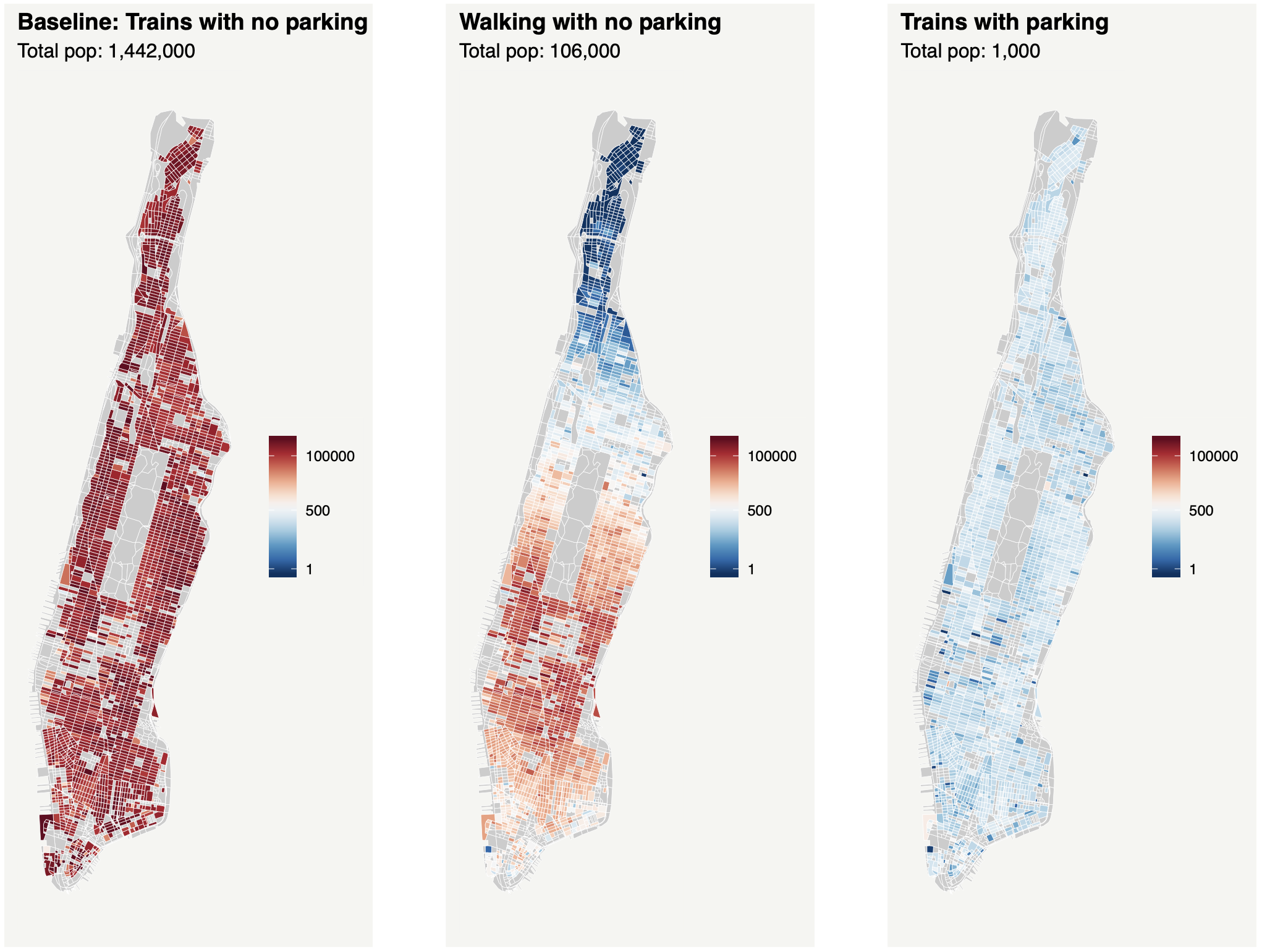
Car-based transportation networks (as in Phoenix) necessitate parking at origin and destination in order to establish a link—but the space devoted to parking lowers its ability to provide housing and consumer amenities. Walking and transit networks (as in Manhattan) have no such tradeoff, and a city reliant on them will be able to make fuller use of its land for productive purposes like amenities and housing. However, they hinder mobility in other ways: walking does not get you far, and using transit requires adhering to the routes and stops the city’s transit agency provides. In this paper, we develop and calibrate a spatial consumer city model to study what would happen if Phoenix banned cars, delineating the roles of parking conversion, of the light rail network, and of a last mile option. Together with a last mile option, Phoenix’s current light rail line would be able to sustain a meaningful (if smaller) population—but only if Phoenix converts its current parking to other uses. We then ask the reverse: what would happen if Manhattan required parking? The model indicates the island would essentially empty, as the declining capacity of each block lowers the vibrancy of the city, inducing still more residents to leave. Altogether, these model outcomes tell a story of agglomeration through complementarities. The transportation network and incumbent land use must ensure a high degree of access to jobs and amenities in order for enough people to choose to live in the city and thereby support those amenities.
Published in Habitat International
